click for ginormous graphic

Source: Floating Sheep
Fast Company:
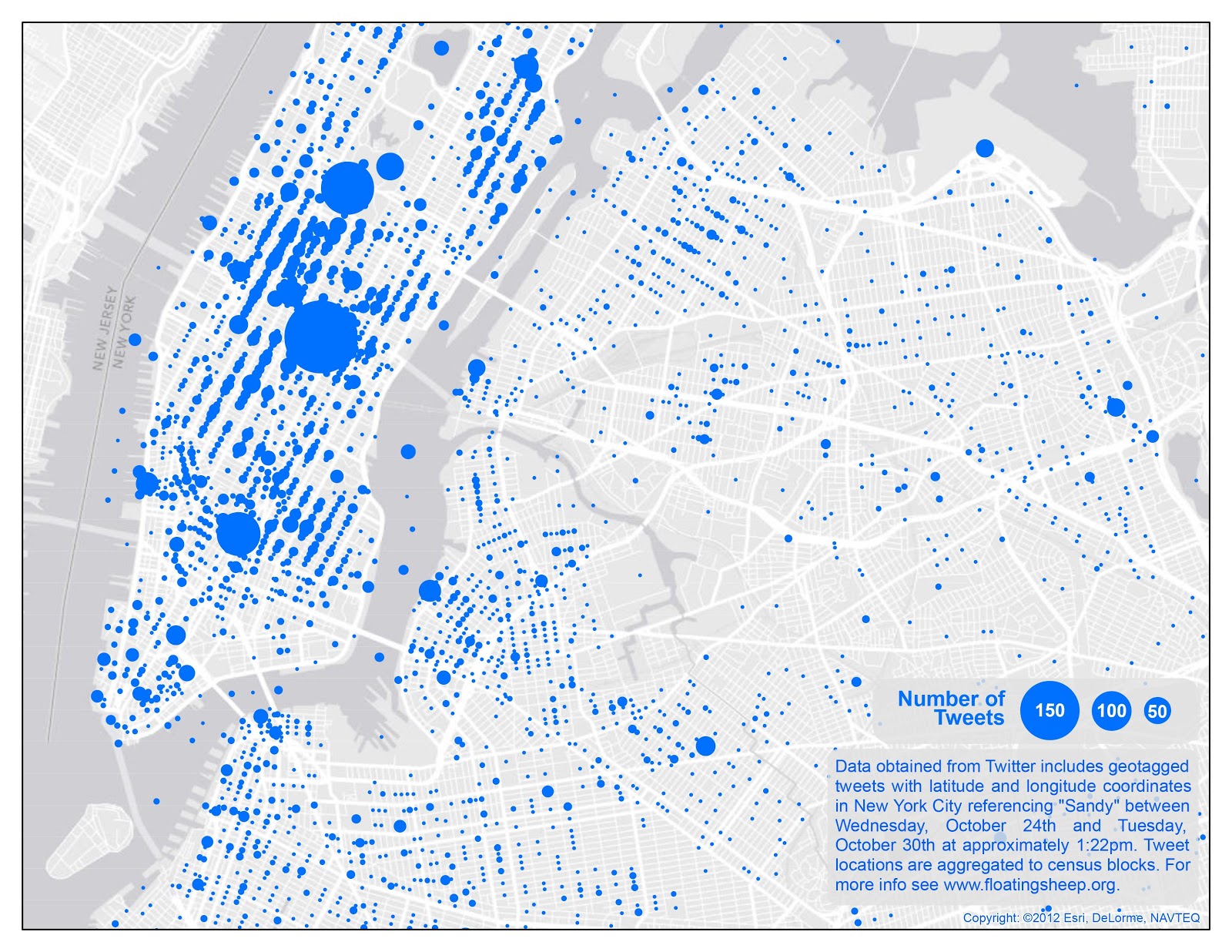
During Hurricane Sandy, New York was, unsurprisingly, the world headquarters of tweets about Sandy. Its involvement in the storm, coupled with its population, made the city the overwhelming social media voice of the event.
Floating Sheep created this map of geotagged tweets that occurred in the days before and during the storm. What they found was that Manhattan, with the greatest population and wealth, put out the most tweets. Some events prompted noticeable responses in various geographic areas–the best example being the infamous crane dangling on 57th street, which appears as a big blue circle just south of Central Park–but other events, like evacuations and explosions, can’t even be spotted on this map.
Source:
Map: How New York Tweeted During Hurricane Sandy
Mark Wilson
Fast Company Design, October 31, 2012
http://www.fastcodesign.com/1671188/map-how-new-york-tweeted-during-hurricane-sandy?utm_source=twitter


What's been said:
Discussions found on the web: