
I notice it every time I fly out to California, Colorado, or Arizona from the East Coast: The vast swaths of untamed wilderness that is the American West. Enormous landscapes of farmland and mountains and deserts and untouched beauty.
Flying into Aspen Monday for a conference this week (I’ll post the deck later this week), I am just gobsmacked by how gorgeous all of this remote snowcapped mountain scenery is, unspoiled by human development.
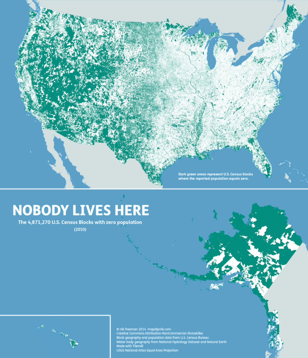
Curiosity got the better of me, and so I looked into population data.
First thing I found was the interesting population map you see above, via mapsbynik. Or more accurately, the lack of population map. The green you see above represents the nearly 5 million Census bureau blocks where the population = 0.
According to the Census Bureau, almost two-thirds of the U.S. population — about 64.4% — lives east of the Mississippi River, on land that amounts to a little more than a third of Continental U.S. land. Meaning, A little more than 1/3 of the population lives on 2/3rds of the land.
We see maps all of the time depicting all manner of things: job creations, wealth, tax receipts, consumption, partisan affiliation, voting patterns. What many of these maps have in common is that they create a misleading picture of the nation.
These are pernicious subtle errors that color our model of the world around us. It’s yet another cognitive error to be aware of.
Error correction aside, I hope to enjoy some of the beautiful scenery today…
Previously:
America is Purple, Not Red & Blue (November 3, 2020)
The Plural of Anecdote IS Data (February 4, 2019)
Cartographs of 2008 US Election Results (November 10, 2008)
Electoral-Vote Cartograph (November 2, 2008)
